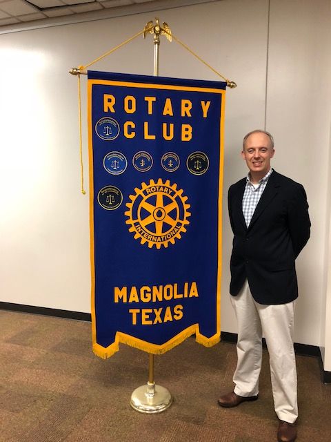
On 3/27/2018, Justin Bower, Senior Environmental Planner from the Houston-Galveston Area Council (H-GAC) spoke to the Magnolia Rotary Club membership about what H-GAC is and what it does in our community. Justin Bower is pictured above.
Justin Bower first explained that H-GAC is the regional organization through which local governments consider issues and cooperate in solving area wide problems. Through H-GAC, local governments also initiate efforts in anticipating and preventing problems and saving public funds. The 13-county H-GAC service region is growing, becoming more diverse, and constantly changing. In order to address the needs of citizens and businesses, local governments are providing leadership to guide regional development wisely and manage change constructively. H-GAC itself has no power to tax or regulate anything or anyone and it is not part of any government entity.
Justin explained further that H-GAC supports a broad spectrum of community and economic development programs, from overseeing federal and state grant programs that deliver waste water and drinking water grants to rural communities and small cities to supporting regional workforce initiatives and partnering on downtown revitalization and community beautification projects. By partnering with the Gulf Coast Small Business Finance Corporation and the Gulf Coast Economic Development District, H-GAC is able to provide community investment grants, support a rural enterprise revolving loan fund, conduct economic impact assessments, and provide a regional perspective via their monthly economic digest.
Justin also spoke of H-GAC's need to gather data to support the scientific evaluation of potential issues. The internal H-GAC group that does this is the Geographic Information System (GIS) Program group. This group facilitate the sharing of geographic data and information resources for the H-GAC region. This includes current and historical aerial imagery acquisition, providing a platform and workflow for H-GAC GIS professionals to share data and analysis via online services, and supporting the GIS needs of H-GAC users and member agencies. The GIS Program group also facilitates and actively participates in the Geographic Data Workgroup’s (GDW) endeavors, such as coordinating GIS education and training, purchasing geographic data and services, and professional outreach such as the GIS Day event and other geo-spatial career development activities. Justin further explained to the group that the GIS Group monitors over 300 ambient monitoring sites and that this data is collected on a quarterly basis.
Justin then explained that the geographical areas that are studied are called "Watershed Areas". A watershed area is all the land that drains to a body of water. By definition, a watershed can vary in size. An example of a watershed in our area is the Spring Creek Watershed. The quality of a body of water can be studied by determining what is on the watershed land that can be washed into the body of water during heavy rains and flooding.
Justin talked about a number of things that are studied in a watershed area:
- Water Standards - studies look for harmful bacteria in the water such as e coli bacteria from both animal and human feces. The ability of a body of water to sustain life is also studied. Specifically, a body of water is studied to determine both nutrients and oxygen levels in the water that can support both fish and plant life.
- Water Quality - studies look at the use of the land in the watershed. Specifically if the land is agriculturally based including farm animals, whether or not certain types of fertilizer is used, the use of industry pollutants that may be allowed to get into the water system and the link between all these potential pollutants and the quality of the water in a body of water.
- Why does it matter? - the quality of the water in a body of water can impact a community, the public health, and the local economy. Any problem in the water quality can trigger an action from the Texas Commission on Environmental Quality (TCEQ).
- Identification - the causes of pollution in a body of water are studied to determine ways to reduce the pollution, the timeline required to reduce the pollution, and what volunteer resources may be used to help in the reduction of the pollutants.
- Protection Plans - the data collected can be used to determine what plans are required to mitigate any issues found during a study.
- Future Use - completed studies can be used as a baseline so that progress in resolving an issue can be measured on an ongoing bases.
Justin then explained that H-GAC very much wants to enlist the help of people local to a watershed because many times they have very good ideas on how to solve an issue. Also, involving locals makes a plan have a better success rate precisely because the locals helped create a plan and don't feel like some big government entity forced a plan on them.
Justin then told everyone that he and Glenn Buckley have been studying the Spring Creek Watershed of which the Lake Creek Greenway is a part. Specifically, Justin indicated that the Spring Creek Watershed is not unique in that it has similar impairments that are seen in other watersheds. Justin indicated that local landowners can help by reducing harmful fertilizers, reducing pet waste that can get into the water system, and making sure agriculture processes do not allow for pollutants to get into a body of water.
Justin then explained that pollutants can also come from a group of areas such as all the lawns in a subdivision. No one lawn can cause a real problem but when all the lawn pollutants drain into a common body of water, the same problems can occur.
For more information about H-GAC, go to: http://www.h-gac.com/home/residents.aspx


